Walking in Central Corfu (South) |
 |
Walking in Central Corfu (South) |
|
Purchasing Walking in Central (South) Corfu
Walking in Central (South) Corfu is on sale at a price of 6.50 euros. To order, click the Buy Now button above which will take you to the payment page on the secure Paypal website where you can pay with an existing Paypal account or with your credit or debit card. After your payment is verified, you will receive the pdf copy by email. (Because sending is not
automated, you will generally receive the file within 24 hours.) THIS PRODUCT IS ONLY AVAILABLE AS AN EBOOK. NO PRINT COPIES EXIST.
Walking in Central (South) Corfu
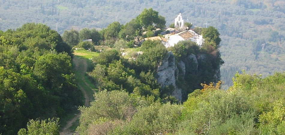
Central Corfu (South) is dominated by the island's second highest mountain range, the Agii Deka Massif, which peaks at 570 metres. Topped by a distinctive radar installation, Mount Agii Deka and its outlying spurs provide some of the most taxing walking terrain in Corfu. To the south east, the spur comprises a ridge which stretches as far as Moraitika. To the south west, another spur terminates in the bulk of Mount Agios Mattheos; and between these two ridges extends the great bowl of the Messongi River. North of the Agii Deka Massif, rolling olive-clad hills are dotted with some of Corfu's prettiest villages, and mazed with tracks and footpaths. Underfoot, the terrain of the walks varies from gentle olive grove tracks to rough and stony footpaths which hug mountainous slopes.
Central (South) Corfu
The Central Corfu (South) walking region has as its northern border the National Pelekas Highway, and stretches southwards to the traditional boundary of Corfu's Deep South, the Messongi River. It also takes in Corfu Town. Some of the resorts and villages close to the area covered by this guide are Pelekas, Sinarades, Agios Gordis, Paramonas, Pentati, Ano and Kato Garouna, Agios Mattheos, Moraitika, Messongi, Strongili, Stavros, Agii Deka, Benitses, Gastouri, Perama and Kastellani. Should you be considering a walking holiday in this area, the mountain community of Stavros is an ideal location to stay. The Corfu Trail passes through the settlement, and it also has direct access to many of the region's best hikes, including ones on and
around the Agii Deka Massif, and several routes down to the coast at Benitses. Accommodation is available in the Dafnata neighbourhood of the village.
Links to other Corfu Walks areas
The Corfu Trail between Pelekas and Vatos connects the Central Corfu (South) region with the Central Corfu (North) walking area, and in the other direction to Deep South Corfu.
Updating Walking in Central (South) Corfu
As a buyer of the book, your name and email address will be kept on
record, and you will be sent FREE UPDATES upon request.
Maps
Unfortunately, graphics greatly increase the size of a pdf file in this format, and their inclusion would prevent dispatch by email of the document. As a result, this book does not contain maps. The best map of Corfu is Freytag and Berndt's 1:50,000 edition, though it is not 100% accurate, and it does not depict most footpaths.
Plant Lists
Flora Ionica -
An inventory of ferns and flowering plants of the Ionian Islands.
Corfu Flowers - Photographs showing many of the island's flowers, identified and named by a botanist whilst walking the Corfu Trail.
Wish to know more about Moraitika and Messongi, two of the most attractive seaside villages in Central South Corfu? This guide will tell you all you need to know.